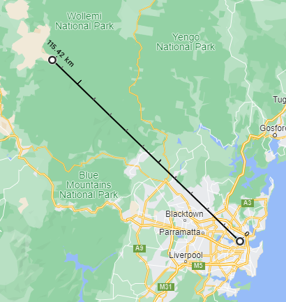
There is a vast canyon less than 120 km, as the crow flies, from the Sydney Opera. It is the Capertee Valley, and it lies in the Greater Blue Mountains just outside Sydney.
The Capertee Valley ranks alongside the Grand Canyon in Arizona and the Grand Canyon of Yarlung in Tibet as one of the largest canyons in the world. At a kilometre wider than the Grand Canyon in the USA, the Capertee Valley wins the crown as the widest canyon in the world.
How the Capertee Valley canyon was formed
For millions of years rivers continuously eroded the earth’s crust to create each of these canyons. Today, the form of the Capertee Valley reflects the greater age of the landscape it has been carved into. It started to be carved into the uplifted sandstone plateau of the Greater Blue Mountains 60 to 90 million years ago. While the Grand Canyon only began to be cut by the Colorado River around six million years ago.
Now, the Capertee River winds across a wide valley floor, in many places, almost turning back on itself. The river starts in the north as the Bogee River heading west, turning south then south-east ultimately cutting through the eastern wall of the canyon to pass the village at Glen Davis and its shale oil processing ruins entering a narrower area to flow with the Wolgan River into the Colo River and then the Hawkesbury-Nepean River.
As you look around the Capertee Valley at the mountains which enclose it, you can see the effects that water has had on this landscape.
Pantoney’s Crown and the canyon cliffs
Most intriguingly, millions of years of water erosion has left the massive mesa of Pantoneyʻs Crown standing alone on the valley floor just inside the southern walls near Baal Bone Gap. As you look at the dip of Baal Bone Gap in the mountain range you can easily imagine a time when water flowed through there. A stream swirling around eroding the softer rock leaving the hard core of remnant volcanic rock which we see today as Pantoney’s Crown.
The work of eroding water can also be seen in the sheer sandstone cliffs which rim the valley. Imagine fast running narrow streams breaking through rock, the crevices and splits it would cause in the sandstone. Below the cliffs, tree-covered flanks sloping down to the valley floor speak of a time when the water had carved a wider path in softer ground.
Mugii Murrum-ban and the pagodas
On Mt Genowlan and Mt Airly a different form of erosion occurred. The geology here saw water erosion create pagoda formations. Think of the beehive formations of the Bungle Bungles, but emerging from bushland rather than desert country.
Pagoda formations are found elsewhere in the world but the ones on Mt Genowlan are rare type with ironstone bonding in sandstone. With the colours reflecting differences in rock type and the presence of algae and lichen, they range from chocolate and orange to pink white and grey.
NSW National Parks says the area which is in Mugii Murrum-ban State Conservation Area is sometimes called the ‘three hundred sisters’, and that it is listed on the Register of the National Estate in recognition of its geomorphological uniqueness.
What to see in the Capertee Valley
When you travel the Bellʻs Line of Road or the Great Western Highway through the townships of the Blue Mountains you are high on the uplifted sandstone plateau looking down into the valleys. In the Capertee Valley, you stand in thousands of acres of farmland looking up at a visual feast of many kilometres of impressive escarpments and mountains.
The cliff-lines in the Capertee Valley are the highest in the Blue Mountains. Near Glen Davis they are more than 300 metres high. Across the rest of the Greater Blue Mountains the cliffs range from a couple of hundred metres down to just tens of metres.
The spectacular Pantoney’s Crown can be seen from many points in the valley. As you descend into the valley from Capertee village, the Airly Fire Trail entrance about 15 kilometre in, has a great view. Travelling south from Rylstone or Kandos, as you come towards Glen Alice look right, and then again after crossing the bridge and the entrance to Umbiella station, look right to see Pantoney’s across the paddocks.
Glen Davis village is in a narrower side canyon. It is one of the places you can get close to the cliffs. It is also where the tallest cliffs can be found. Continue on Glen Davis Road from the intersection with Glen Alice Road, cross the bridge at the Capertee River and turn right onto Gullies Road. At the end of Gullies Road you are surrounded by the cliffs, and unable to see into the wider valley.
On Genowlan Road, see the whole south end of the valley. Just after you turn into Genowlan Road there is a small crest. Pull off right on top of the crest to get the biggest view in the valley.
At the Dunville Loop intersection with Glen Alice Road there is a shaded area you can pull off into. Walk to the fence and in front of you is the northern end of the valley. The semi-circle of mountains around rolling farmland is the where the rain gathers into the rivers and creeks which make their way back and forth across the valley before they flow out past Glen Davis into the Colo River.
For more to see and do in the Capertee Valley see:
Birdwatching – Coming soon
History – Coming soon
Bushwalking – Coming soon
How to get to the Capertee Valley
The Capertee Valley is accessible:
- from the Castlereagh Highway at the ridge-top village of Capertee. Turn into Glen Davis Road and descend into the valley.
- from Rylstone on the Bylong Way turn into the street next to Rylstone Hospital which becomes Glen Alice Road and follow the signs towards Glen Alice and Glen Davis.
- from Kandos, follow the signs towards Wollemi National Park and at the junction with Glen Alice Road turn right instead of continuing to follow the Wollemi National Park signs.
From Kandos and Rylstone, when you pass the Mid-Western Council farewell sign and start to go downhill you are entering the Capertee Valley.
Inside the valley, Glen Davis and Glen Alice Roads intersect connecting Capertee with Rylstone and Kandos.
For more information about visiting the Capertee Valley, make sure you don’t accidentally call it the Capertree Valley!